Page MenuHomePhabricator

Clustering `<mapframe>` and `<maplink>` markers on maps
Open, LowestPublic

Assigned To
None
Authored By
JGirault
May 27 2016, 10:12 PM
Referenced Files
F4223517: Screen Shot 2016-07-01 at 6.09.00 PM.png
Jul 2 2016, 1:41 AM
F4223512: Screen Shot 2016-07-01 at 6.08.09 PM.png
Jul 2 2016, 1:41 AM
F4223510: Screen Shot 2016-07-01 at 6.07.59 PM.png
Jul 2 2016, 1:41 AM
F4223515: Screen Shot 2016-07-01 at 6.08.38 PM.png
Jul 2 2016, 1:41 AM
F4223506: Screen Shot 2016-07-01 at 6.07.08 PM.png
Jul 2 2016, 1:41 AM
F4223507: Screen Shot 2016-07-01 at 6.07.27 PM.png
Jul 2 2016, 1:41 AM
Tokens
"Like" token, awarded by Liuxinyu970226.

Description

The nearby feature includes a cluster library that allows the creation of clusters from markers. This library could also be used to cluster user input added from <mapframe> and <maplink>. The library supports clustering in different cluster groups so it would be possible to have differently styled cluster layouts to transparently distinct between markers from different source that should not be grouped together.

Still it's not clear how this functionality should be offered to the authors / readers. So some questions remain:

  • How can we make sure that the clustering layout reflects user expectations best?
  • Should it be configurable in the wikitext or enabled by default?
  • Should we allow inline plugin configuration? (cluster -group, -size, -cothese markers reflectslor, -icon?)
  • Should it always cluster by group, or just distinguish by source?

Examples:

  • Note that the screenshots are taken from the prunecluster library the currently favored markercluster works similar though.
  • The layout of the cluster icons is a major thing that needs to be defined.
without marker clusterwith marker cluster
Screen Shot 2016-07-01 at 6.07.08 PM.png (628×832 px, 276 KB)
(zoom=4)
Screen Shot 2016-07-01 at 6.08.09 PM.png (616×820 px, 261 KB)
(zoom=4)
Screen Shot 2016-07-01 at 6.07.27 PM.png (620×824 px, 255 KB)
(zoom=5)
Screen Shot 2016-07-01 at 6.07.59 PM.png (620×822 px, 234 KB)
(zoom=5)
Screen Shot 2016-07-01 at 6.08.38 PM.png (620×834 px, 324 KB)
(zoom=6)
Screen Shot 2016-07-01 at 6.09.00 PM.png (618×822 px, 345 KB)
(zoom=6)

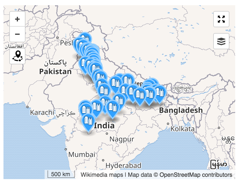
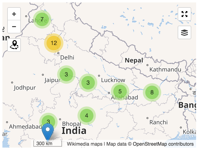
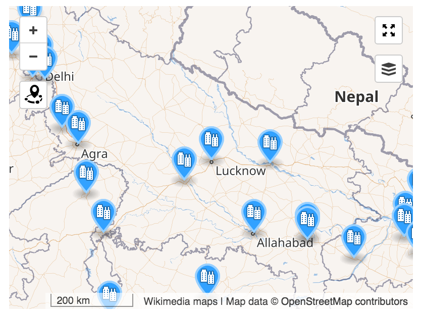
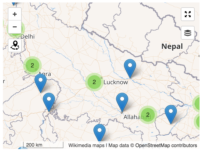
See https://github.com/Leaflet/Leaflet.markercluster for the plugin currently in use.

Event Timeline

Restricted Application added a subscriber: Zppix. · View Herald Transcript

Is this task about loading the large datafile with all of wikivoyage data points, or is it about when should we enable/disable leaflet poi clustering plugin?

JGirault renamed this task from Decide if and when <maplink> and <mapframe> shoud load the marker cluster resource to Should we use the marker cluster plugin with `<mapframe>` and `<maplink>` ?.Jul 2 2016, 1:41 AM
JGirault updated the task description. (Show Details)

My opinion is that we should by default, and if there is a demand for it, allow users to turn it off with an attribute. One thing - in the images above, the ungrouped markers on the right side do not show with the original icons. I presume this is simply a demo limitation, not the future behavior.

Yurik removed a project: Maps-Sprint.
MSantos triaged this task as Lowest priority.Nov 27 2018, 4:16 PM
WMDE-Fisch renamed this task from Should we use the marker cluster plugin with `<mapframe>` and `<maplink>` ? to Clustering `<mapframe>` and `<maplink>` markers on maps.Mar 16 2023, 9:55 AM
WMDE-Fisch updated the task description. (Show Details)

I took the freedom to change the ticket a bit. While implementing T304076: Nearby feature for maps we used a different clustering library that eventually will replace prunecluster and the Wikivoyage nearby feature. There were already some questions from the community on giving clustering to features added via mapframe and maplink so I wanted to give these requests a new more up to date home where feedback can be collected.

Disclaimer: WMDE Will will most probably not have the resources to work on this.

I'm also a bit weary about this ticket to begin with.

You see, clustering is really useful in an interactive mode where you have a lot of data, especially if that data is more 'optional'. But the maps made by our users generally are very specific and pointy. Many will actually want individual points for some of the markings. If anything, I think it will be more worthy to explore the option of adding smaller map markers, so more dots can be shown at once. There have been several requests for that, yet Im not aware of a single user having asked for the functionality in this ticket.