Page MenuHomePhabricator

Pikne
User

Projects

User does not belong to any projects.

Today

  • Clear sailing ahead.

Tomorrow

  • Clear sailing ahead.

Monday

  • Clear sailing ahead.

User Details

User Since
Mar 3 2015, 8:51 AM (456 w, 4 d)
Availability
Available
LDAP User
Unknown
MediaWiki User
Pikne [ Global Accounts ]

Recent Activity

Thu, Nov 30

Pikne added a comment to T322139: Special:NewLexeme and wbcontentlanguages in the API do not use the same language names for additional languages.

This makes me wonder, how did this came to be that these language names are maintained in multiple places, or is it even intentional?

Thu, Nov 30, 9:39 PM · MW-1.42-notes (1.42.0-wmf.7; 2023-11-28), Wikidata Dev Team, Wikidata, Wikidata Lexicographical data

Mon, Nov 27

Pikne merged T351607: geoshape service does not redender particular shape into T312938: Multiple overlapping OSM area relations with the same QID are imported as a single polygon with unwanted hole(s).
Mon, Nov 27, 8:27 AM · Regression, Maps (Maps-data), WMDE-GeoInfo-FocusArea
Pikne merged task T351607: geoshape service does not redender particular shape into T312938: Multiple overlapping OSM area relations with the same QID are imported as a single polygon with unwanted hole(s).
Mon, Nov 27, 8:27 AM · Maps (Geoshapes)

Wed, Nov 22

Pikne added a comment to T228612: Place names get cut off and unreadable due to placement of neighbouring labels.

I'm no longer sure why I figured that this one relates to the placement neighbouring labels. It also occurs on tile boundry, and so the root cause is likely the same as in that other task. Closely packed labels might somehow contribute to this issue but I don't really know.

Bell.png (226×857 px, 60 KB)

Wed, Nov 22, 9:17 AM · Maps (Map-Styles)

Mon, Nov 20

Pikne renamed T312938: Multiple overlapping OSM area relations with the same QID are imported as a single polygon with unwanted hole(s) from Some geoshapes are shown inverse to Multiple overlapping OSM area relations with the same QID are imported as a single polygon with unwanted hole(s).
Mon, Nov 20, 3:55 PM · Regression, Maps (Maps-data), WMDE-GeoInfo-FocusArea
Pikne added a comment to T351607: geoshape service does not redender particular shape.

That's another case of T312938: Multiple overlapping OSM area relations with the same QID are imported as a single polygon with unwanted hole(s).

Mon, Nov 20, 2:54 PM · Maps (Geoshapes)

Thu, Nov 9

Pikne merged T348469: Map labels fall back to an arbitrary name in the same writing system into T195318: Suffixed keys like "name:sr-Latn", specific to one language, are used to latinize other languages.
Thu, Nov 9, 8:25 AM · Maps (Kartotherian)
Pikne merged task T348469: Map labels fall back to an arbitrary name in the same writing system into T195318: Suffixed keys like "name:sr-Latn", specific to one language, are used to latinize other languages.
Thu, Nov 9, 8:24 AM · Maps (Kartotherian)

Mon, Nov 6

Pikne added a comment to T342815: Provide an API for creating dropdowns in Vector and Vector legacy.

I notice that patches here make use the nullish coalescing operator (??). In some older browsers, possibly including some browsers of Grade A support, this seems to break most of site JavaScript.

Mon, Nov 6, 1:12 PM · Verified, MW-1.42-notes (1.42.0-wmf.3; 2023-10-31), Web-Team-Backlog (Web Team FY2023-24 Q2 Sprint 2), Desktop Improvements (Vector 2022)

Oct 29 2023

Pikne added a comment to T349685: jsondata API endpoint caches Data:.map's for 24 hours and does not purge on edit.

Update: It was not the Name property. Gonna test now if it was the altitude or the other change

Oct 29 2023, 7:20 AM · Maps, JsonConfig, Wikidata

Oct 25 2023

Pikne added a comment to T349685: jsondata API endpoint caches Data:.map's for 24 hours and does not purge on edit.

A working example is https://www.wikidata.org/wiki/Q122936541#P3896

Oct 25 2023, 7:48 PM · Maps, JsonConfig, Wikidata
Pikne added a comment to T349685: jsondata API endpoint caches Data:.map's for 24 hours and does not purge on edit.

So by "fails" you mean that mapdata isn't diplayed on a map next to Commons link in this Wikidata item page? To me it seems that item pages just aren't set to display this data (using mapframe or otherwise). If I'm not missing something in browser console then it doesn't try to load respective jsondata on this page nor on any other item page with P3896 statement.

Oct 25 2023, 1:26 PM · Maps, JsonConfig, Wikidata
Pikne added a comment to T349685: jsondata API endpoint caches Data:.map's for 24 hours and does not purge on edit.

What exactly is not working on Wikidata as expected? Where is this jsondata query used? Is there an example page?

Oct 25 2023, 11:58 AM · Maps, JsonConfig, Wikidata

Oct 20 2023

Pikne closed T192947: Russia label is not shown at all at devel as Declined.

Most tasks relating to these undeployed styles were closed/declined long ago so I'm closing this one too.

Oct 20 2023, 7:05 AM · Maps (Map-Styles)

Oct 12 2023

Pikne added a comment to T348469: Map labels fall back to an arbitrary name in the same writing system.

See T195318. We have been considering it might be better to simply ignore suffixed language keys.

Oct 12 2023, 5:27 PM · Maps (Kartotherian)

Sep 28 2023

Pikne edited projects for T311203: Geoline referencing individual way(s) with a QID renders empty map, added: Maps (Maps-data), Regression; removed Maps (Kartographer).
Sep 28 2023, 5:27 PM · Regression, Maps (Maps-data), WMDE-TechWish, WMDE-GeoInfo-FocusArea
Pikne added a subtask for T288730: [EPIC] Fix bugs introduced by imposm3 migration: T311203: Geoline referencing individual way(s) with a QID renders empty map.
Sep 28 2023, 5:27 PM · Maps, Product-Infrastructure-Team-Backlog-Deprecated
Pikne added a parent task for T311203: Geoline referencing individual way(s) with a QID renders empty map: T288730: [EPIC] Fix bugs introduced by imposm3 migration.
Sep 28 2023, 5:27 PM · Regression, Maps (Maps-data), WMDE-TechWish, WMDE-GeoInfo-FocusArea
Pikne closed T288400: New imposm3 setup provides some broken links for geoshapes when requesting linestrings as Resolved.

I'm closing this one as originally reported examples work now. About the remaining regression there's T311203: Geoline referencing individual way(s) with a QID renders empty map.

Sep 28 2023, 5:21 PM · Product-Infrastructure-Team-Backlog-Deprecated (Kanban), Maps (Kartotherian)
Pikne closed T288400: New imposm3 setup provides some broken links for geoshapes when requesting linestrings, a subtask of T156433: Geoline/geoshape does not work with relations other than multipolygon/route/boundary, as Resolved.
Sep 28 2023, 5:20 PM · Community-Wishlist-Survey-2022, Maps (Kartotherian)
Pikne closed T288400: New imposm3 setup provides some broken links for geoshapes when requesting linestrings, a subtask of T288730: [EPIC] Fix bugs introduced by imposm3 migration, as Resolved.
Sep 28 2023, 5:20 PM · Maps, Product-Infrastructure-Team-Backlog-Deprecated

Aug 5 2023

Pikne closed T341226: Features with geometry null cause errors as Resolved.

Just recently we run into this again and fixed it in one place, see https://gerrit.wikimedia.org/r/901538. Is this the reason for the 400? I.e. is this a duplicate of T331977?

Aug 5 2023, 7:45 AM · Maps (Kartotherian)

Jul 16 2023

Pikne closed T223880: When using auto-positioning, Special:Map displays confusing/misleading caption "Invalid coordinates supplied" as Resolved.

It seems this issue no longer comes up. Thanks!

Jul 16 2023, 2:34 PM · MW-1.41-notes (1.41.0-wmf.1; 2023-03-20), Maps (Kartographer)

Jul 14 2023

Pikne added a comment to T341226: Features with geometry null cause errors.

I suppose it's still worth pointing out from original task description that full screen mapframe map (its dynamic content) wasn't broken. So what we might ask for here more specifically is to treat the data in more uniform manner, i.e. take either approach:

  1. if this GeoJSON was invalid and shouldn't be expected to work then break the map entirely (also in full screen), or
  2. if Kartographer can skip bad features in GeoJSON and still show the rest of the data then also add this capability to snapshot service.
Jul 14 2023, 2:38 PM · Maps (Kartotherian)
Pikne updated the task description for T340143: Avoid treating an object with waterway tag as water area.
Jul 14 2023, 2:05 PM · Maps (Map-Styles)

Jul 6 2023

Pikne added a comment to T341226: Features with geometry null cause errors.

In browser console these 400s have the following response: Cannot read property 'coordinates' of null. The map data for all of these three examples include features that lack geometry ("geometry": null) which I assume breaks snapshot image. So I suppose the image would appear if JSON data was cleaned up and these particular features were removed from it?

Jul 6 2023, 5:01 PM · Maps (Kartotherian)

Jun 23 2023

Pikne closed T148253: Overlapping border lines turns dashes into solid lines as Resolved.

It doesn't seem to occur anymore. I suppose it was fixed as part of the work done in subtask. Please reopen if I miss something.

Jun 23 2023, 3:13 PM · Maps (Map-Styles)
Pikne merged T145226: Text clipping for multiline labels into T228812: Place names get cut off and unreadable on tile boundary.
Jun 23 2023, 3:00 PM · Maps (Kartotherian)
Pikne merged task T145226: Text clipping for multiline labels into T228812: Place names get cut off and unreadable on tile boundary.
Jun 23 2023, 3:00 PM · Maps (Map-Styles)
Pikne closed T113690: Road lines are missing pieces as Resolved.

This doesn't seem to occur any more. Please reopen if miss something.

Jun 23 2023, 2:18 PM · Maps (Map-Styles)
Pikne renamed T340143: Avoid treating an object with waterway tag as water area from Fix the color of the land mass of Assam in wikimaps to Avoid treating an object with waterway tag as water area.
Jun 23 2023, 8:05 AM · Maps (Map-Styles)
Pikne added a comment to T340143: Avoid treating an object with waterway tag as water area.

Assam example is mainly about a tagging error in source data, introduced a couple of weeks ago. I now fixed it (see OSM history), and tiles are expected to update within a few days, too.

Jun 23 2023, 7:50 AM · Maps (Map-Styles)

Jun 7 2023

Pikne added a comment to T333318: Improve tile storage for maps.wikimedia.org .

is there a specific reason the tile viewer at https://maps.wikimedia.org/ was broken?

Misconfiguration. This specific one is fixed, we still have a few pending items though.

Jun 7 2023, 10:31 AM · Patch-For-Review, serviceops, Maps, Wikimedia-Hackathon-2023

May 19 2023

Pikne added a comment to T336952: Wikibase\DataModel\Services\Lookup\ReferencedEntityIdLookupException: Referenced entity id lookup failed. Tried to find a referenced entity out of Q16334295 linked from Q13406463 via P279.

And when x got redirected then x in turn got double redirected (as it had been redirected to x a little earlier). By now a bot has fixed the double redirect in x. So was double redirect in a class tree enough to break the mw.wikibase.getReferencedEntityId call?

May 19 2023, 11:34 AM · MW-1.41-notes (1.41.0-wmf.10; 2023-05-23), Wikidata, [DEPRECATED] wdwb-tech, MediaWiki-General, Wikimedia-production-error

May 2 2023

Pikne updated subscribers of T335648: Fullscreen map is blank if opened twice.

It looks this issue is there since 1.41/wmf.6 branch. Does it relate to T333160?

May 2 2023, 6:25 AM · MW-1.41-notes (1.41.0-wmf.10; 2023-05-23), WMDE-TechWish-Sprint-2023-05-03, WMDE-GeoInfo-FocusArea, Maps (Kartographer), WMDE-TechWish-Sprint-2023-04-19, Regression

Apr 19 2023

Pikne updated the task description for T335046: "Reload results" action dislocates overlay linestrings/polygons.
Apr 19 2023, 3:44 PM · WMDE-GeoInfo-FocusArea, Maps (Kartographer)
Pikne created T335046: "Reload results" action dislocates overlay linestrings/polygons.
Apr 19 2023, 3:43 PM · WMDE-GeoInfo-FocusArea, Maps (Kartographer)
Pikne renamed T289828: Maps shouldn't render a non-road with access=private as road from Maps shouldn't render amenity=parking as service road to Maps shouldn't render a non-road with access=private as road.
Apr 19 2023, 2:44 PM · Maps (Maps-data), Product-Infrastructure-Team-Backlog-Deprecated (Kanban)
Pikne merged T334413: Garden is rendered as road into T289828: Maps shouldn't render a non-road with access=private as road.
Apr 19 2023, 2:42 PM · Maps (Maps-data), Product-Infrastructure-Team-Backlog-Deprecated (Kanban)
Pikne merged task T334413: Garden is rendered as road into T289828: Maps shouldn't render a non-road with access=private as road.
Apr 19 2023, 2:42 PM · Maps (Map-Styles)
Pikne closed T316995: Intermittent incomplete highlight of OSM route relation as Resolved.

This should be fixed now. Around the time when this task was created some replica map servers were out of sync.

Apr 19 2023, 2:30 PM · Maps

Apr 10 2023

Pikne added a comment to T289828: Maps shouldn't render a non-road with access=private as road.

It looks this is actually specific to access=private key not amenity=parking. T334413 has an example where a garden is rendered the same.

Apr 10 2023, 8:53 PM · Maps (Maps-data), Product-Infrastructure-Team-Backlog-Deprecated (Kanban)

Mar 19 2023

Pikne added a subtask for T203863: StaticMapFrame configuration ignored when previewing a page: T311295: Make "static" preview look more like the static image.
Mar 19 2023, 8:15 PM · Maps (Kartographer)
Pikne added a parent task for T311295: Make "static" preview look more like the static image: T203863: StaticMapFrame configuration ignored when previewing a page.
Mar 19 2023, 8:15 PM · Maps (Kartographer), WMDE-GeoInfo-FocusArea

Feb 14 2023

Pikne added a comment to T288400: New imposm3 setup provides some broken links for geoshapes when requesting linestrings.

The only possibility I can see is to explore the imposm mapping and include more relation types.

The remaining regression here is that individual ways, not part of a relation, are missing via geoline.

Feb 14 2023, 6:31 PM · Product-Infrastructure-Team-Backlog-Deprecated (Kanban), Maps (Kartotherian)

Feb 13 2023

Pikne added a comment to T310259: Add option to edit interlanguage links as an option on the language selector.

... the "edit language links" option, unlike other options such as "Translate" is not displayed for pages not available in other languages

I still wonder, shouldn't the links and functionality be the same as in old Vector, i.e. display "Add (interlangauge) links" link instead of "Edit interlanguage links", both when not connected to Wikidata and also when connected to Wikidata but without sitelinks in other languages (example)? This link opens the "Link with page" dialog (for logged-in users) instead of directing the user to Wikidata.

Feb 13 2023, 1:44 PM · MW-1.40-notes (1.40.0-wmf.22; 2023-02-06), User-Michael, Wikidata Dev Team (Sprint-∞), User-ItamarWMDE, Desktop Improvements (Vector 2022), Wikidata, UniversalLanguageSelector

Feb 7 2023

Pikne added a comment to T326790: Only make map elements focusable that have an interaction.

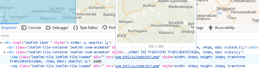
Oh, indeed, now that I look closer I realize that this outline is not for a tile. It's fixed to the map centre while tiles aren't, and it's only tile-shaped.

Feb 7 2023, 4:04 PM · WMDE-TechWish-Sprint-2023-03-14, MW-1.40-notes (1.40.0-wmf.24; 2023-02-20), WMDE-TechWish-Sprint-2023-01-18, Accessibility, Maps (Kartographer), WMDE-GeoInfo-FocusArea
Pikne added a comment to T326790: Only make map elements focusable that have an interaction.

I wonder if this also concerns individual background tiles that recently got blue focus outlines (T315997). Individual tiles don't really have interaction either, do they? If so then these shouldn't be focusable either nor have focus outline, right? At first, till I found respective task, I suspected this new and confusing tile outline is some sort of bug.

Feb 7 2023, 3:22 PM · WMDE-TechWish-Sprint-2023-03-14, MW-1.40-notes (1.40.0-wmf.24; 2023-02-20), WMDE-TechWish-Sprint-2023-01-18, Accessibility, Maps (Kartographer), WMDE-GeoInfo-FocusArea

Feb 3 2023

Pikne added a comment to T328793: Don't always request static snapshots when previewing mapframes.

Currently there seem to be some limited use for static snapshots if previewing in VisualEditor. That is if mapframe is generated via wrapper template and map is without JSON overlay. E.g. if I edit map in the following article then new snapshot is visible in preview:
https://et.wikipedia.org/wiki/Johan_Laidoneri_plats?veaction=edit
(If such map has JSON overlay and is edited in VisualEditor then just broken mapframe without any image is displayed in preview, partly because we wanted to avoid a defective snapshot preview getting cached in case autopositioning is used.)

Feb 3 2023, 6:21 PM · MW-1.40-notes (1.40.0-wmf.24; 2023-02-20), WMDE-GeoInfo-FocusArea, WMDE-TechWish-Sprint-2023-01-18, Maps (Kartographer)
Pikne added a comment to T310259: Add option to edit interlanguage links as an option on the language selector.

Currently it shows "Edit language links" link also if article is connected to an item and if there are no sitelinks in other languages yet. Probably instead there should be a link to open Wikibase Client's link with page widget, the one that can be accessed via sidebar, also when item yet isn't connected to Wikidata. Is this covered in some other task?

Feb 3 2023, 12:51 PM · MW-1.40-notes (1.40.0-wmf.22; 2023-02-06), User-Michael, Wikidata Dev Team (Sprint-∞), User-ItamarWMDE, Desktop Improvements (Vector 2022), Wikidata, UniversalLanguageSelector

Jan 31 2023

Pikne added a comment to T288400: New imposm3 setup provides some broken links for geoshapes when requesting linestrings.

Querying from both tables requires a little extra work AFAIC. I'll investigate that.

Jan 31 2023, 8:26 AM · Product-Infrastructure-Team-Backlog-Deprecated (Kanban), Maps (Kartotherian)

Jan 30 2023

Pikne edited projects for T312938: Multiple overlapping OSM area relations with the same QID are imported as a single polygon with unwanted hole(s), added: Maps (Maps-data); removed Maps (Kartographer).
Jan 30 2023, 5:35 PM · Regression, Maps (Maps-data), WMDE-GeoInfo-FocusArea
Pikne added a comment to T312938: Multiple overlapping OSM area relations with the same QID are imported as a single polygon with unwanted hole(s).

It looks like there is just no place in the relation tables to store the information if a hole in a shape is intentional or not.

In docs it says "Imposm uses geometry operations to verify if a member of a multipolygon is a hole, or if it is a separate polygon." This generally works fine, as long as data from multiple relations don't get mixed up somehow.

Jan 30 2023, 5:06 PM · Regression, Maps (Maps-data), WMDE-GeoInfo-FocusArea
Pikne added a comment to T312938: Multiple overlapping OSM area relations with the same QID are imported as a single polygon with unwanted hole(s).

... we shouldn't try to change it. Not with the remaining resources we have.

Jan 30 2023, 1:12 PM · Regression, Maps (Maps-data), WMDE-GeoInfo-FocusArea
Pikne added a comment to T318510: Preview mapframes should appear static if the wiki is configured to only show static mapframes.

What about arrow key controls? In beta these appear to be still enabled. Also, if I enter full screen, then zoom/pan and exit full screen, then would it be possible to reset the position?

Jan 30 2023, 12:26 PM · MW-1.40-notes (1.40.0-wmf.23; 2023-02-13), WMDE-TechWish-Sprint-2023-01-18, WMDE-TechWish-Sprint-2023-01-04, WMDE-TechWish-Sprint-2022-11-29, WMDE-GeoInfo-FocusArea, WMDE-TechWish, Maps (Kartographer)

Jan 29 2023

Pikne created T328225: Change visibilty button displayed to local admins on local description page of a Commons file.
Jan 29 2023, 4:27 PM · MW-1.40-notes (1.40.0-wmf.21; 2023-01-30), MediaWiki-Revision-deletion, Commons, MediaWiki-File-management

Jan 25 2023

Pikne added a comment to T306865: Missing lakes in maps (again).

Tiles did look fine earlier when the data was served from eqiad but it seems old tiles resurfaced now after switching to codfw. I suppose the regeneration of all tiles was forced in eqiad but not in codfw, or something like that? @Jgiannelos could you please check.

Jan 25 2023, 5:11 PM · Product-Infrastructure-Team-Backlog-Deprecated, Maps

Jan 9 2023

Pikne updated the task description for T156433: Geoline/geoshape does not work with relations other than multipolygon/route/boundary.
Jan 9 2023, 4:27 PM · Community-Wishlist-Survey-2022, Maps (Kartotherian)
Pikne added a comment to T326560: Accept `site` type when importing OSM relations.

I think the main difficulty with site is that it's designed to gather multiple geometries (areas, lines, points). So if it's supported then we should also make sure that it's indicated what its different parts actually stand for. The same applies to public_transport and street. In case of boundary and route we keep only the main geometry, respectively area or line, but for these other more complex relation types this probably wouldn't work as well.

Jan 9 2023, 4:08 PM · Maps (Kartotherian)
Pikne added a subtask for T156433: Geoline/geoshape does not work with relations other than multipolygon/route/boundary: T326560: Accept `site` type when importing OSM relations.
Jan 9 2023, 4:08 PM · Community-Wishlist-Survey-2022, Maps (Kartotherian)
Pikne added a parent task for T326560: Accept `site` type when importing OSM relations: T156433: Geoline/geoshape does not work with relations other than multipolygon/route/boundary.
Jan 9 2023, 4:08 PM · Maps (Kartotherian)

Jan 5 2023

Pikne added a comment to T313010: Map shows wrong shape in the article, but not in full size map view - shape doesn't update .

What type could the OSM object have so that it would show here?

For instance "multipolygon". A few hours ago someone changed given relation to this type once again. But this necessarily isn't solution as it can be changed again, also others may complain that Wikimedia user is tagging for the renderer. In this case it's difficult to agree what the proper tagging in OSM should be.

Jan 5 2023, 9:43 PM · Maps (Kartographer), WMDE-GeoInfo-FocusArea

Dec 13 2022

Pikne created T325052: Default mapframe size to default thumbnail image width.
Dec 13 2022, 11:02 AM · Maps (Kartographer)

Dec 6 2022

Pikne added a comment to T324450: rendering of mapframe is unstable.

Possibly the fix is already merged, but not yet deployed, see T323307: Kartotherian autozoom not showing results on single points.

Dec 6 2022, 3:37 PM · Maps (Kartotherian)

Dec 4 2022

Pikne added a comment to T324421: Add return data on OSM requests.

See also T209067: Provide way to check if reference to external data returns external data.

Dec 4 2022, 7:22 PM · Maps (Kartographer)

Nov 21 2022

Pikne added a comment to T313010: Map shows wrong shape in the article, but not in full size map view - shape doesn't update .

In the meantime associated OSM relation (r14300290) has been changed to unsupported type=site. So empty data is expected now.

Nov 21 2022, 11:16 AM · Maps (Kartographer), WMDE-GeoInfo-FocusArea

Nov 18 2022

Pikne merged T323035: Lakes not visible in Infobox map into T306865: Missing lakes in maps (again).
Nov 18 2022, 12:28 PM · Product-Infrastructure-Team-Backlog-Deprecated, Maps
Pikne merged task T323035: Lakes not visible in Infobox map into T306865: Missing lakes in maps (again).
Nov 18 2022, 12:28 PM · Maps (Kartographer)

Nov 17 2022

Pikne added a comment to T316759: TemplateData output should generate an [edit] link that launches the TemplateData GUI.

Currently it reuses message for previous button text, but it'd nice to use different capitalization (lower case first letter) for a bracketed link, similar to other bracketed links that appear in e.g. recent changes or history pages.

Nov 17 2022, 7:40 PM · User-notice-archive, Verified, MW-1.40-notes (1.40.0-wmf.10; 2022-11-14), Editing-team (Kanban Board), VisualEditor, TemplateData

Nov 14 2022

Pikne added a comment to T322104: Variable blue tiles in Ethiopia.

I'm assuming it is just using one of the broken (out of sync) db nodes ? T321885

Nov 14 2022, 3:41 PM · Maps (Maps-data)
Pikne added a comment to T322104: Variable blue tiles in Ethiopia.

This corresponds to previous revision of respective OSM object. It was corrupt briefly around September 27th, see https://osm.virtuelle-loipe.de/history/?type=relation&ref=192800.

Nov 14 2022, 3:00 PM · Maps (Maps-data)
Pikne merged T322980: Interwiki links are wrong when using Wikidata query on fr:wiki into T168601: Wikicode in map data is always rendered in enwiki if data is from Sparql.
Nov 14 2022, 12:28 PM · Maps (Kartotherian)
Pikne merged task T322980: Interwiki links are wrong when using Wikidata query on fr:wiki into T168601: Wikicode in map data is always rendered in enwiki if data is from Sparql.
Nov 14 2022, 12:28 PM · Maps (Kartographer)

Nov 4 2022

Pikne added a comment to T322351: Investigation: Keep simplified geoshapes in maps database.

My understanding of how this all works is vague. If simplified data is kept in addition to unsimplified data then I suppose I got the wrong idea what this task is about.

Nov 4 2022, 11:42 AM · WMDE-TechWish-Sprint-2022-11-09, WMDE-TechWish-Maintenance, WMDE-GeoInfo-FocusArea, WMDE-TechWish-Sprint-2022-10-26, Maps (Kartotherian)
Pikne added a comment to T322351: Investigation: Keep simplified geoshapes in maps database.

So this means that raster tiles too would be generated based on inaccurate data? I doubt this is desirable. Don't we also need unsimplified data so that T155919 could be improved in some form?

Nov 4 2022, 10:50 AM · WMDE-TechWish-Sprint-2022-11-09, WMDE-TechWish-Maintenance, WMDE-GeoInfo-FocusArea, WMDE-TechWish-Sprint-2022-10-26, Maps (Kartotherian)

Nov 3 2022

Pikne added a comment to T309745: [M] Update the "results from other language wiki" section to match the new layout and styling..

I think it's fair to aim for greater than sufficient :)

Sure. It's just that due to translation issues current wording seems less sufficient than previous one. I think return to status quo may be considered an improvement as long as there isn't a better solution.

Nov 3 2022, 2:41 PM · MW-1.40-notes (1.40.0-wmf.14; 2022-12-12), SDAW-Search-Improvements (Milestone 1: CSS changes to all wikis), Structured-Data-Backlog (Current Work)
Pikne added a comment to T309745: [M] Update the "results from other language wiki" section to match the new layout and styling..
  1. The easiest: keep wiki name at the beginning of the sentence, so result will be something like "English Wikipedia doesn't have articles named オジブワ"

... do you have any concerns with this proposal?

Nov 3 2022, 2:10 PM · MW-1.40-notes (1.40.0-wmf.14; 2022-12-12), SDAW-Search-Improvements (Milestone 1: CSS changes to all wikis), Structured-Data-Backlog (Current Work)

Oct 20 2022

Pikne added a comment to T321236: geoshapes and geomasks are broken when there are duplicate Q items in OSM.

It looks to me that here too a multi-polygon is improperly built from multiple OSM objects. In case of this geomask example it looks that geometry from one OSM object is used for outer mask area, and identical geometry from another OSM objects gets treated as an inner area, without a cap between the two

Oct 20 2022, 5:06 PM · WMDE-GeoInfo-FocusArea, Maps (Kartotherian)

Oct 19 2022

Pikne added a comment to T321236: geoshapes and geomasks are broken when there are duplicate Q items in OSM.

This might be a special case of T312938: Multiple overlapping OSM area relations with the same QID are imported as a single polygon with unwanted hole(s).

Oct 19 2022, 8:25 PM · WMDE-GeoInfo-FocusArea, Maps (Kartotherian)

Oct 6 2022

Pikne added a comment to T319077: Error: Cannot use object of type stdClass as array.

Per merged task steps to reproduce is to submit/preview mapframe tag without width/height attributes. I remember that earlier an error message was displayed in place of mapframe tag in this case. Does this relate to recent work on Kartographer's error handling?

Oct 6 2022, 7:21 AM · MW-1.40-notes (1.40.0-wmf.6; 2022-10-17), Regression, Unplanned-Sprint-Work, WMDE-TechWish-Sprint-2022-09-28, Maps (Kartographer), Wikimedia-production-error
Pikne merged T319028: "Error: Cannot use object of type stdClass as array" into T319077: Error: Cannot use object of type stdClass as array.
Oct 6 2022, 7:20 AM · MW-1.40-notes (1.40.0-wmf.6; 2022-10-17), Regression, Unplanned-Sprint-Work, WMDE-TechWish-Sprint-2022-09-28, Maps (Kartographer), Wikimedia-production-error
Pikne merged task T319028: "Error: Cannot use object of type stdClass as array" into T319077: Error: Cannot use object of type stdClass as array.
Oct 6 2022, 7:19 AM · Maps (Kartographer)

Sep 30 2022

Pikne added a comment to T309745: [M] Update the "results from other language wiki" section to match the new layout and styling..

The project-localized-name-* messages are not designed to be used in a sentence context. They are not inflected and letter casing is not for the sentence context.

Sep 30 2022, 2:59 PM · MW-1.40-notes (1.40.0-wmf.14; 2022-12-12), SDAW-Search-Improvements (Milestone 1: CSS changes to all wikis), Structured-Data-Backlog (Current Work)

Sep 28 2022

Pikne added a comment to T302861: Actually update the Maki icons.

Thiemo found /.../ Maki has dropped the outlines on symbol icons

Sep 28 2022, 10:34 AM · Accessibility, WMDE-TechWish-Sprint-2022-08-31, WMDE-TechWish-Sprint-2022-08-17, WMDE-TechWish-Sprint-2022-08-03, WMDE-GeoInfo-FocusArea, Maps (Kartographer)

Sep 26 2022

Pikne closed T318530: Enable wgCiteResponsiveReferences on etwiki as Resolved.
Sep 26 2022, 1:36 PM · Wikimedia-Site-requests
Pikne created T318530: Enable wgCiteResponsiveReferences on etwiki.
Sep 26 2022, 10:59 AM · Wikimedia-Site-requests
Pikne added a comment to T188443: Wrap indicators in mw-parser-output class.

I'm curious: why the entire .mw-indicators block or at least the individual #mw-indicator-<id> element wasn't wrapped inside .mw-parser-output? I've found it useful to target #mw-indicator-<id> in CSS as it allows me to adjust e.g. vertical alignment of an individual indicator without affecting alignment of other indicators inside the block, and it'd be nice to do so via TemplateStyles as well.

Sep 26 2022, 10:14 AM · MW-1.39-notes (1.39.0-wmf.17; 2022-06-20), MediaWiki-Interface, TemplateStyles

Aug 26 2022

Pikne added a subtask for T316365: Restore the map data health and parity between clusters: T314472: Re-import full planet data into eqiad and codfw.
Aug 26 2022, 3:55 PM · WMDE-TechWish-Sprint-2023-01-18, WMDE-TechWish-Sprint-2023-01-04, WMDE-TechWish-Sprint-2022-11-09, WMDE-TechWish-Sprint-2022-10-26, WMDE-TechWish-Sprint-2022-09-14, WMDE-GeoInfo-FocusArea, WMDE-TechWish-Sprint-2022-08-31, Maps (Maps-data)
Pikne added a parent task for T314472: Re-import full planet data into eqiad and codfw: T316365: Restore the map data health and parity between clusters.
Aug 26 2022, 3:55 PM · serviceops, Maps
Pikne added a comment to T310289: Map preview does not display lines and markers on article page.

I followed this task due to my example https://de.wikipedia.org/wiki/Philippsruher_Allee not working. Should this be resolved now? Because for me it still doesn't work and I have no clue how to fix it.

Currently it doesn't work for me neither. I now created T316365 to gather issues on outdated data. Likely the cause for this example is the same.

Aug 26 2022, 3:53 PM · WMDE-TechWish, Regression, WMDE-GeoInfo-FocusArea, Maps (Kartographer)
Pikne created T316365: Restore the map data health and parity between clusters.
Aug 26 2022, 3:46 PM · WMDE-TechWish-Sprint-2023-01-18, WMDE-TechWish-Sprint-2023-01-04, WMDE-TechWish-Sprint-2022-11-09, WMDE-TechWish-Sprint-2022-10-26, WMDE-TechWish-Sprint-2022-09-14, WMDE-GeoInfo-FocusArea, WMDE-TechWish-Sprint-2022-08-31, Maps (Maps-data)
Pikne closed T310289: Map preview does not display lines and markers on article page as Resolved.

Potentially related to T292613?

Aug 26 2022, 3:04 PM · WMDE-TechWish, Regression, WMDE-GeoInfo-FocusArea, Maps (Kartographer)

Aug 22 2022

Pikne closed T232720: Red pin (location mark) on a map is not shown anymore when opening the map image as Invalid.

I'm closing this as "Invalid" per my previous comment. This is about template design which is an on-wiki issue and also alternatives exist. Please reopen and respond if you disagree.

Aug 22 2022, 6:35 PM · Maps, MediaWiki-File-management, Commons

Aug 19 2022

Pikne added a comment to T218097: [Bug] OSM DB degradation during sync as a result of missing features.

.... a DC switchover that brought old and broken data in the codfw cluster

Aug 19 2022, 12:38 PM · Patch-For-Review, Maps (Maps-data)
Pikne added a comment to T315647: Possible problem with geoshapes and geolines service.

Currently the only OSM object referring x is this:
https://www.openstreetmap.org/relation/22494
https://www.openstreetmap.org/relation/27116
This relation is of type=network which isn't/wasn't supported.

Aug 19 2022, 12:08 PM · Maps (Geoshapes), WMDE-GeoInfo-FocusArea

Aug 4 2022

Pikne merged T313844: Geoline/Geoshape queries don't return geojson for QID into T311203: Geoline referencing individual way(s) with a QID renders empty map.
Aug 4 2022, 9:18 AM · Regression, Maps (Maps-data), WMDE-TechWish, WMDE-GeoInfo-FocusArea
Pikne merged task T313844: Geoline/Geoshape queries don't return geojson for QID into T311203: Geoline referencing individual way(s) with a QID renders empty map.
Aug 4 2022, 9:18 AM · Maps (Geoshapes)

Aug 1 2022

Pikne added a comment to T313844: Geoline/Geoshape queries don't return geojson for QID.

Is there any reason why a circle in OSM can't be retrieved as a line, but only as shape?

As mentioned, T288400 has the hints. This behaviour is affected by patches referenced in this other task. Since last year geoline objects are queried from new database table which includes objects that are built from only relations. Geoshape objects are queried from different database table(s).

Aug 1 2022, 5:10 PM · Maps (Geoshapes)
Pikne added a comment to T313844: Geoline/Geoshape queries don't return geojson for QID.

... the OSM relationship attribute in Wikidata is being used for Kartographer

It isn't and it's easy to find examples where geoshape/geoline object can be retrieved without Wikidata property, e.g. see item Q3743006 and its geoshape (from way/26900845). As far as I can recall, Wikidata ids were perceived to be more stable than OSM ids, for both ways and relations, and this is why geoshape/geoline queries don't rely on OSM ids.

Aug 1 2022, 1:45 PM · Maps (Geoshapes)
Pikne changed the status of T311343: Determine VideoJS localization strategy from Stalled to Open.

If this task is only for consultation, then we can place it on a different column.

Aug 1 2022, 9:13 AM · Upstream, translatewiki.net, I18n, VideoJS player