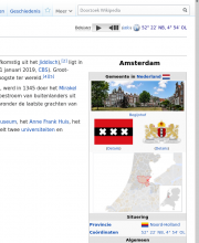
On nl-wiki many articles have in the top right corner coordinates with next to it a link (Kaart) to expand a map. (Like on Amsterdam in the right top corner.)
A user reported for Haava (Võru) that the pink polygon on the expanding map is from the wrong town (it shows the polygon of Haava-Tsäpsi) and that the actual town is over 35 kilometers from the pink polygon. The coordinates in the Wikipedia article and in Wikidata are right, still the map shows the wrong polygon.
A user reports that the map is running on an very old OpenStreetmap dump on the servers of Wikimedia which needs to be updated. Can this old OSM dump be updated?

