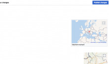
I've noticed that (on English Wikipedia at least) where <mapframe> is used without latitude and longitude specified in the tag, the automatic zoom and centering only works on page preview (with the wikitext editor).
Example:
- https://www.mediawiki.org/wiki/User:Evad37/sandbox/mapframe shows a map with geoline data from Q1094308
- Most of Europe and the top half of Africa is visible in the frame, and the line featured isn't centered in the frame
- https://www.mediawiki.org/w/index.php?title=User:Evad37/sandbox/mapframe&action=edit (Note: Switch to wikitext editor if visual editor is your default; and push the Show preview button if you don't have the 'Show preview on first edit' preference enabled)
- The frame is zoomed and centered such that the line feature is centred in the frame, and just fits within its extents
Viewing the page should give the same result as previewing the page (otherwise what's the point of preview?); preferably both should have auto-zooming and centering.
(originally reported with https://en.wikipedia.org/wiki/Template:Maplink/doc#Usage as the example, but that template is now getting coords for the frame from wikidata)
The difference in behaviour is likely determined by whether this is a live (dynamic/JS map) or a rendered (img based) map.
Note that preview mode showing an interactive map rather than a static map is T203863


