Page MenuHomePhabricator

show osm shapes on coordinates
Open, Needs TriagePublicFeature

Description

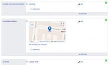
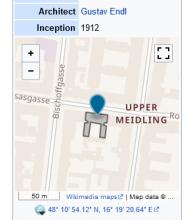
I want to have OSM shapes shown on P625 (coordinates) automatically to have better visual control. This should be done similar to Commons:Template:Wikidata Infobox.

Describe the impact that solving this problem will have on users:

  • will show mismatch / inaccuracy of id / coordinates visually.

Describe the implications/cost of not doing this request:

  • Inconsistencies of geographical coordinates and assigned shapes on OSM will not popup automatically. While this is rather instructive inside Wikidata Infobox on a commons category, we will not have commons categories for all wikidata items with coordinates.

Example (if applicable):

Event Timeline

Hi @Herzi.Pinki,

I am looking at both pages and it looks like both are showing the same OSM maps.

Could you please add a screenshot of what you are referring to?

@hoo @Mike_Peel Does either of you know where this is coming from? I can't find any shape definition in the related Wikidata Item or Commons pages. Is it just taking whatever OSM has there as an object?

@hoo @Mike_Peel Does either of you know where this is coming from? I can't find any shape definition in the related Wikidata Item or Commons pages. Is it just taking whatever OSM has there as an object?

Yes the shape is coming from OSM, when OSM-item is connected to Wikidata Item via wikidata property. In this specific case: https://www.openstreetmap.org/way/139218871

Sorry for the belated response. The process of getting the geoshape is described at https://www.mediawiki.org/wiki/Help:Extension:Kartographer#Via_Wikidata_ID - it works in reverse from the usual setup, you have the Wikidata QID on the OSM feature, and Kartographer somehow manages to query for that and pull the shape over to display it. (It's not stored on Wikidata since OSM IDs aren't stable.)

Adding Edward, chatting to him at the Hackathon he may have useful input here. :-)