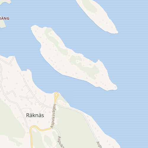
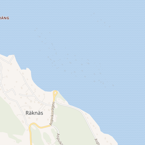
In the OpenStreetMap maps imported to Wikimedia, bays can hide islands within them. An example of this is an island Gressholmen just outside Oslo, Norway. The island itself is not visible on the map, but zoomed sufficiently paths and houses on the island can be seen underneath the water. Links to maps below.
I asked about this on the Norwegian mailing list for OpenStreetMap, and learned first that this was probably because there was modelled a bay there. Later that this apparently is a common cause and that it is common that users of OpenStreetMap gets this wrong. However I was told that the community around osm2pgsql have a way to deal with it. The fact that this island is clearly shown on OpenStreetMap.org testifies to that.
There are other cases I managed relatively easily to find, eg. close to Stockholm.
I don't know if Tag:natural=bay is a unique case.
Example Gressholmen (Wikidata Q952279):
Wikimedia:
https://maps.wikimedia.org/?lang=nb#16/59.8837/10.7188
OpenStreetMap.org:
https://www.openstreetmap.org/?mlat=59.8824&mlon=10.7173&zoom=15#map=15/59.8824/10.7173
OpenStreetMap.org item for the island:
https://www.openstreetmap.org/way/4154441#map=16/59.8825/10.7187
OpenStreetMap.org item for the bay:
https://www.openstreetmap.org/relation/6812187/#map=11/59.8064/10.7206