Page MenuHomePhabricator

Wikimedia map tiles don't show some natural features (e.g. lakes) after zoom 10
Closed, ResolvedPublicBUG REPORT

Description

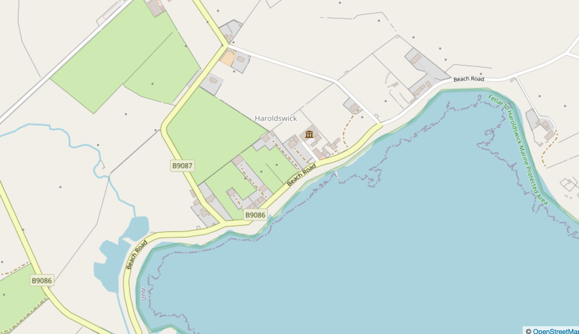
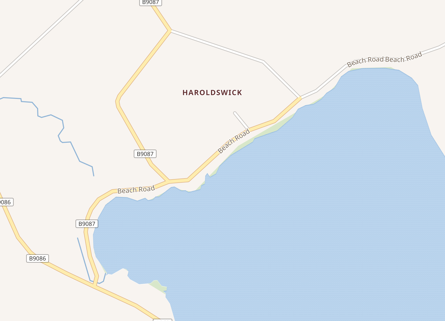
List of steps to reproduce (step by step, including full links if applicable):

  • Open Wikimedia Maps
  • Find an impacted Lake or other impacted natural features (note: it occurs for several lakes and natural features but not all lakes: see section "what happens" for a partial list of impacted lakes)
  • Zoom after 9

What happens?:

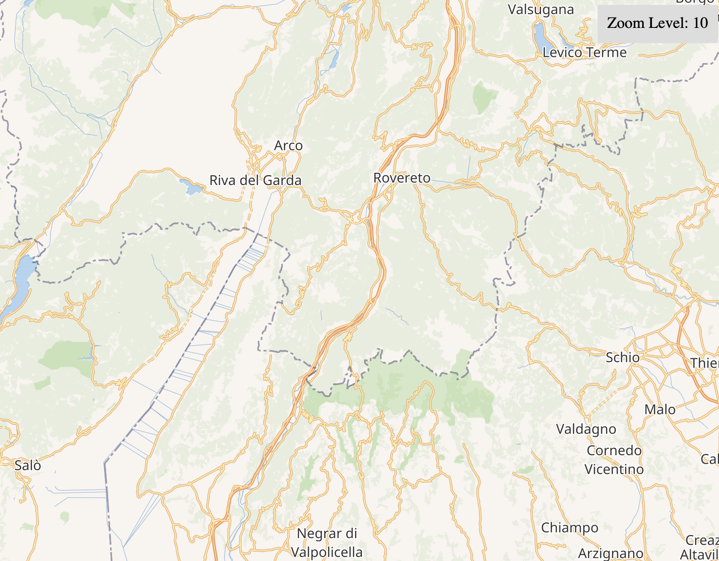
After zoom 10, Wikimedia map tiles (e.g. coords 45.6246 10.6664) stop to show some involved natural features (e.g. lakes), also when included in other apps

Let's take the Garda lake as an example. As you can see from the video, while in OpenStreetMap the Garda Lake is shown at every zoom level, in Wikimedia maps tiles the lake disappears starting from zoom=10.

This happens also with other lakes (e.g. Ginevra, Maggiore, Garda, Bodensee, Balaton, Michigan, Superiore, Victoria). This doesn't happen with some lakes (e.g. Como, Lugano, Erie, Ontario). This happens also with the Rhine-Westerwald Nature Park in Germany (coords: 50.5492 7.4432).

What should have happened instead?:

All those lakes and other impacted natural features should be shown even at higher zoom levels, as in OpenStreetMap (e.g. https://openstreetmap.org/#11/45.6246/10.6664), like the other lakes and natural features that don't suffer from this problem.

Related Objects

Event Timeline

Ferdi2005 renamed this task from Wikimedia map tiles don't show lakes after zoom 10 to Wikimedia map tiles don't show some lakes after zoom 10.Aug 16 2021, 1:24 PM
Ferdi2005 updated the task description. (Show Details)

(Please attach/upload images in Phabricator, as imgur.com loads third-party tracking content - thanks.)

@Aklapper I tried two times: with a gif and with a mp4, but Phabricator continued giving me this error (which hasn't been fixed since then):

Exception: No configured storage engine can store this file. See "Configuring File Storage" in the documentation for information on configuring storage engines.

With any luck these illustrate the issue, although clicking on https://maps.wikimedia.org/#9/45.7004/10.5139 and zooming around shows the problem.

I don't think there's anything more going on than that WMF map tiles are VERY OLD; and tiles for 10 & 11 are older than tiles for 9 & below ... what we're seeing is the map being drawn, probably years ago.

So the takeaway, I think, may well be: what arrangements, if any, do WMF have to refresh map tiles; and are these arrangements a) good enough b) working.

I see that none of my OSM changes made in the last 15 months have yet made it to WMF maps. #headDesk

Screenshot 2021-08-16 at 18.13.01.png (1×1 px, 1 MB)

Screenshot 2021-08-16 at 18.12.53.png (1×1 px, 1 MB)

Screenshot 2021-08-16 at 18.12.44.png (1×1 px, 861 KB)

@Ferdi2005: Ah, I'm sorry then! Files can be up to 4MB. The two mp4 files on imgur.com are <3MB. If it doesn't work on Phab, please file a new task here - thanks! :)

@Aklapper Ouch, the original are 50+ MB, I think Imgur does some sort of compression. I've now downloaded them from Imgur and uploaded here.

The same issue also occurs for rendering of other natural areas such as woods. E.g. compare different zoom levels of Rhine-Westerwald Nature Park in Germany: https://maps.wikimedia.org/#9/50.5492/7.4432, https://maps.wikimedia.org/#10/50.5492/7.4432, https://maps.wikimedia.org/#12/50.5492/7.4432

Ferdi2005 renamed this task from Wikimedia map tiles don't show some lakes after zoom 10 to Wikimedia map tiles don't show some natural features (e.g. lakes) after zoom 10.Aug 17 2021, 10:15 AM
Ferdi2005 updated the task description. (Show Details)

After some investigation, it seems that polygons are being lost during the OSM sync process, therefore tiles from z0 to z9 contains old pre-generated tiles in a point of time where the polygons still existed in database, since this range of tiles is rendered on a different pace.

In general, tiles from z10 to z15 are refreshed once every day (due to resource constraints) and OSM database sync runs every hour.

I'm still investigating a solution, thanks for all the provided information and the patience.

EDIT: there's a potential upstream bug https://github.com/omniscale/imposm3/issues/260

I don't think there's anything more going on than that WMF map tiles are VERY OLD; and tiles for 10 & 11 are older than tiles for 9 & below ... what we're seeing is the map being drawn, probably years ago.

So the takeaway, I think, may well be: what arrangements, if any, do WMF have to refresh map tiles; and are these arrangements a) good enough b) working.

I see that none of my OSM changes made in the last 15 months have yet made it to WMF maps. #headDesk

If this is only a refresh issue, I think it would be worth the effort to make it possible for (some?) users to add a refresh request for an area, a wikidata item or something. I got a question a few days ago on no.wikipedia about an area where something added two years back to OSM are not shown on Wikimedia maps. It would be nice not to have to create an issue here for each single one of these.

in fact, it's more than a refresh issue; WMF choose to use maptiles which filter out most of the useful information. Compare WMF and OSM at the same resolution for Haroldswick, in the Shetlands:

https://www.openstreetmap.org/#map=16/60.7892/-0.8299

Screenshot 2021-08-17 at 12.08.17.png (1×1 px, 669 KB)

https://maps.wikimedia.org/#16/60.7881/-0.8280

Screenshot 2021-08-17 at 12.08.05.png (1×1 px, 252 KB)

Change 713827 had a related patch set uploaded (by MSantos; author: MSantos):

[operations/puppet@production] maps: update imposm mapping

https://gerrit.wikimedia.org/r/713827

Change 713827 merged by Hnowlan:

[operations/puppet@production] maps: update imposm mapping

https://gerrit.wikimedia.org/r/713827

Mentioned in SAL (#wikimedia-operations) [2021-08-23T09:55:44Z] <mbsantos> start re-import OSM planet data into maps1009 eqiad master (T288400, T288897)

MSantos edited projects, added Maps (Maps-data); removed Maps.

@MSantos what's the current status of this issue btw ? Still broken, fixed, fixed but needs to propagate ?
Because someone was reporting this problem in Discord for the Great Lakes today.

Is there any update @MSantos? The bug is still there.

@TheDJ and @Ferdi2005 sorry for the late response. I've posted an explanation about our finds during the investigations on this issue and how we are working to have a proper fix at T218097: [Bug] OSM DB degradation during sync as a result of missing features. Please let me know if you have any questions or concerns.

I see that three other tickets were merged into this one as duplicates:

T295839: Space aliens have eaten several of the great lakes..Nov 16 2021, 22:07
T295841: Maps missing some of the great lakes.Dec 18 2021, 09:16
T298813: Interactive maps do not show most of Great Lakes.

The symptoms are fairly severe, Lake Huron/Georgian Bay, Lake Erie, Lake Ontario and the entire western half of the 1000 Islands are pretty much a desert, just gone, except for a few small features like a certain waterfall in the Niagara region and a canal from Kingston Mills to Ottawa.

https://en.wikivoyage.org/w/index.php?title=Wikivoyage:Travellers%27_pub&oldid=4386356#What_happened_to_the_Great_Lakes?

Do you mean to tell us that this has been this way since 2021?

Do you mean to tell us that this has been this way since 2021?

Correct. In some form of way this has been since 2021 (possibly even longer).

The lakes have finally returned.