Feature summary
I would like to be able to see geographic features such as residentials areas, houses, buildings, fields, fences, &c, on higher resolution WMF maps, following roughly the pattern established by OSM as their default tile set, or by ACME Mapper, a 3rd party user of OSm maps.
Steps to reproduce
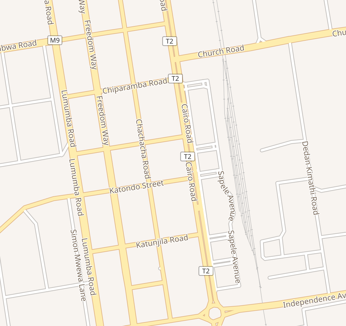
- View https://www.wikidata.org/wiki/Q102206627#P625 - try to find the church
- View https://mapper.acme.com/?ll=60.79810,-0.81467&z=17 - try to find the church
- View https://www.openstreetmap.org/#map=17/60.79772/-0.81514 - try to find the church
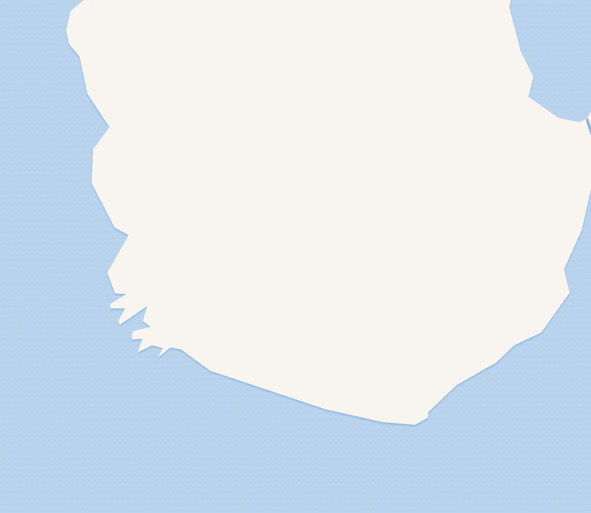
The WMF map is bereft of residential areas, houses, buildings, fields, fences, &c. No church.
OSM and ACME show residential areas, houses, buildings, fields, fences, &c
Use case(s)
I have, for instance, 67,313 Scottish Listed Buildings items, each with coordinates pointing to a building or structure. In the main, none of the buildings or structures are shown on any WMF map tile.
I wish the user, when viewing a Scottish Listed Building item having coordinates, to be able to see the building in the wikidata map.
I wish the user of other implemtations of the WMF map tiles - such as on the geohack page - to be able to see the building for which coordinates have been supplied.
I wish to be able to check, visually, that a coordinate is accurate, by reference to the WMF map tile displayed proximate with the coordinate string, such as within a wikidata P625 statement.
I wish to be able to validate that summit coordinates point to summits. Summits are not shown on WMF map tiles. (see below)
I wish to ascertain that P131 values - administrative areas - are correct for geocoded items. WMF maps do not show administrative boundaries. (see below).
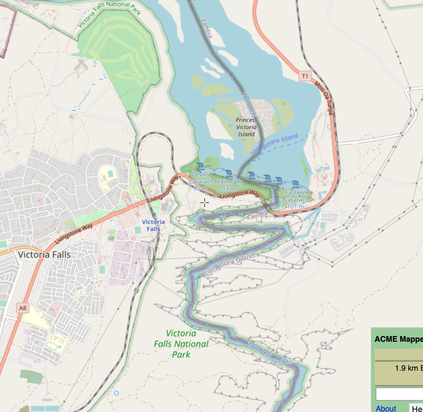
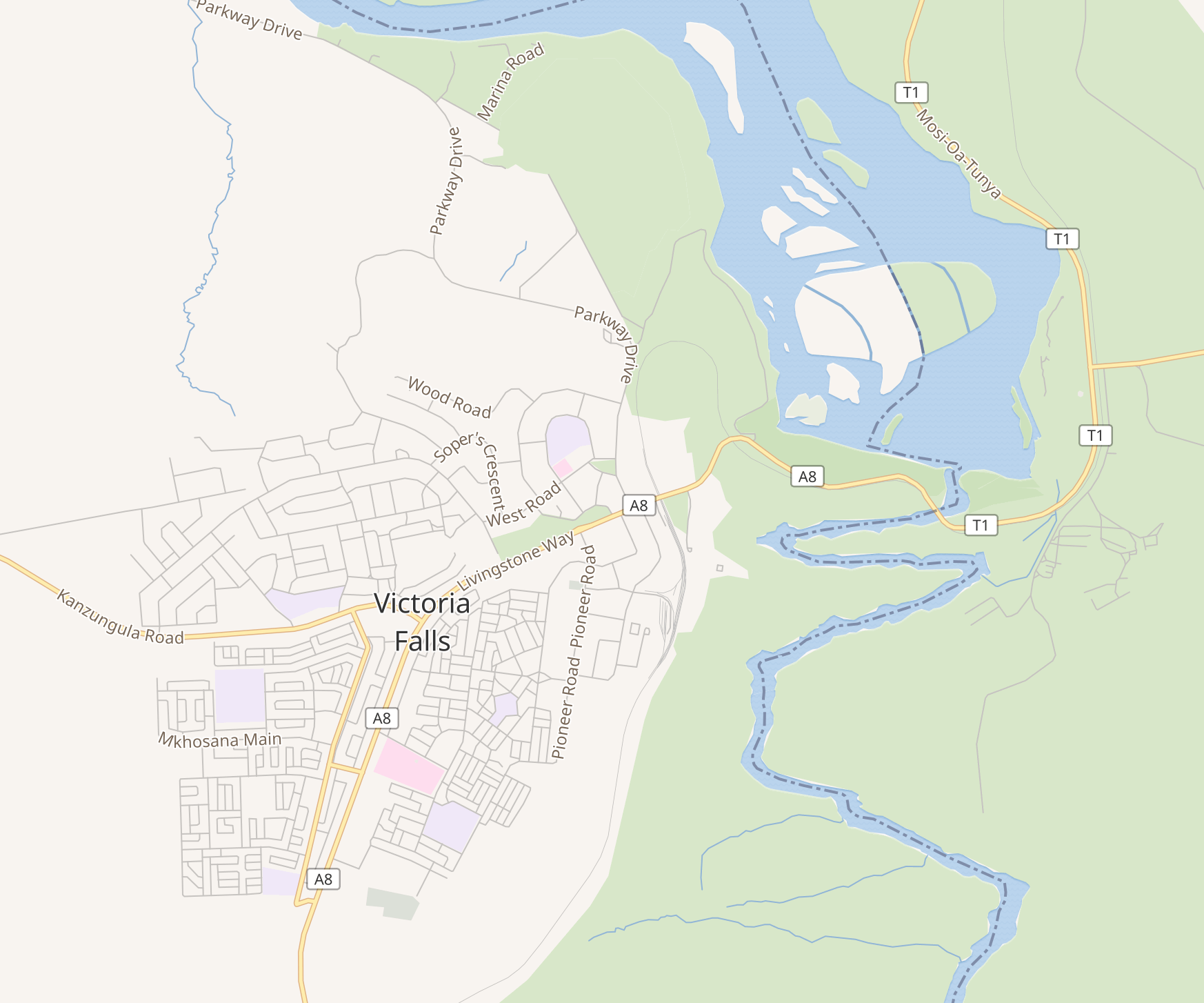
I wish to be able to differentiate railways from roads - see the Victoria Falls example, below - for instance to check geocoding of stations.
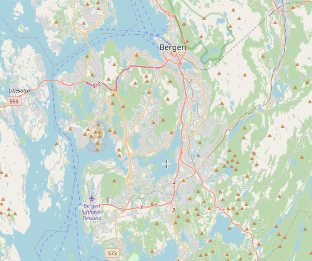
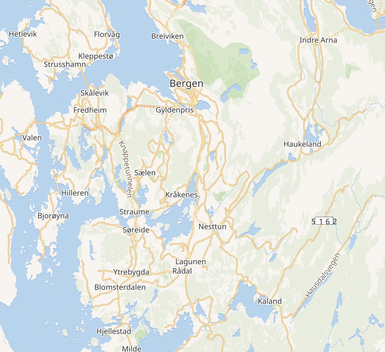
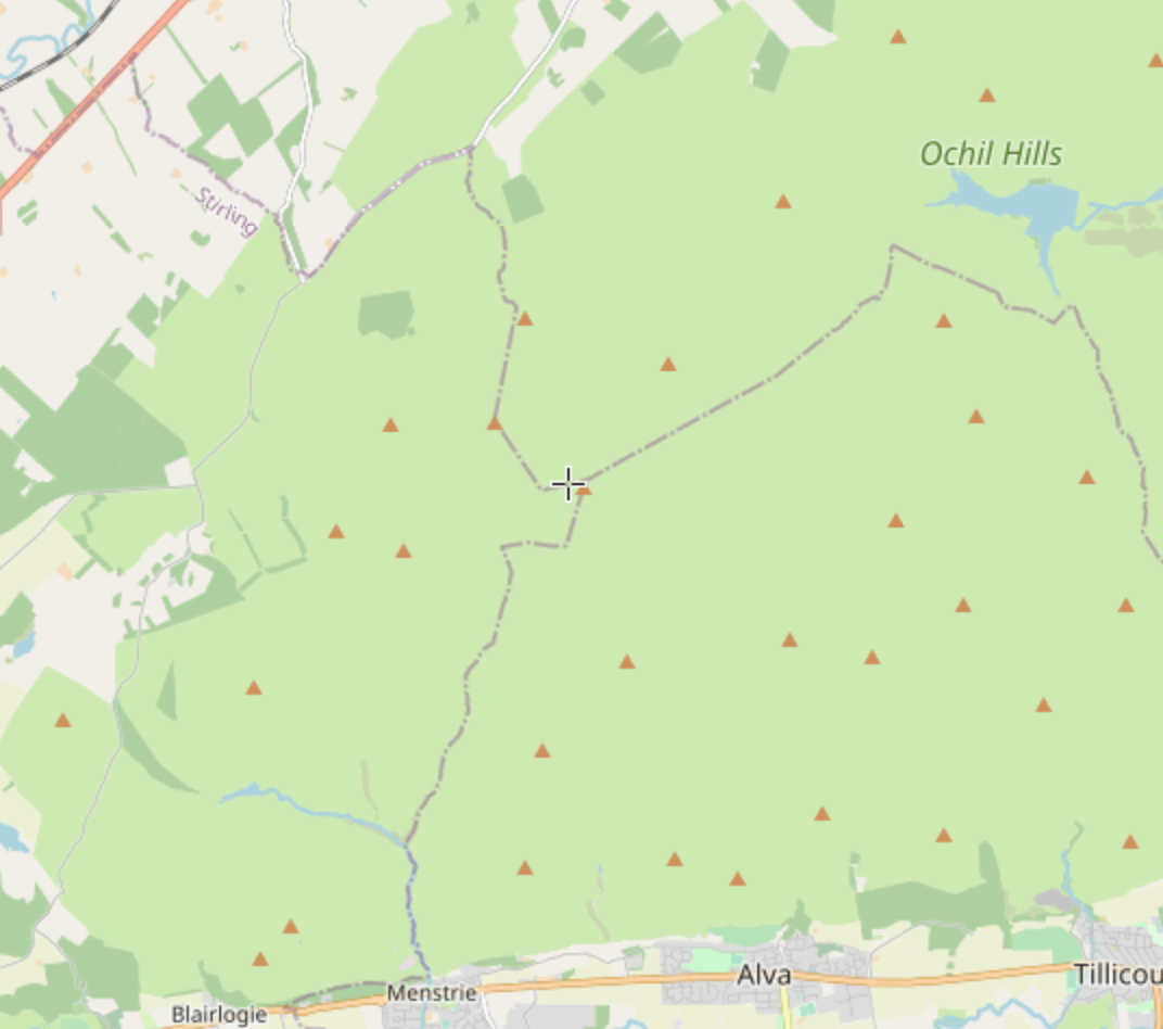
The issues manifests in rural areas north and south (Shetland and Victoria Falls, below), cities north and south (Edinburgh & Lusaka, below), hinterlands such as the Ochil Hills in Scotland, or the countryside around Bergen, Norway, below. The issues manifest everywhere.
In the alternative, I want WMF to explain why it is better, or even acceptable, that at higher resolution, WMF tiles are mostly devoid of features, whilst OSM and ACME manage to render excellent and detailed tiles.
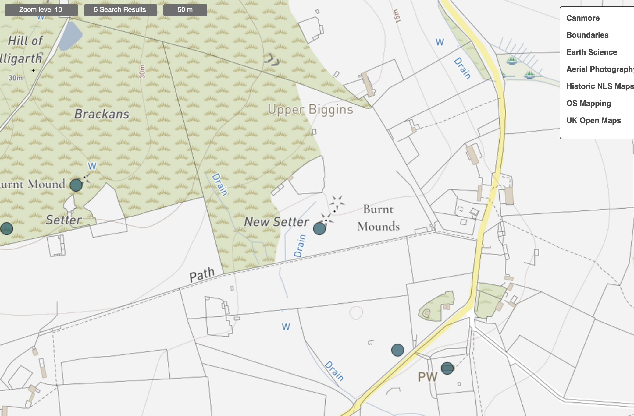
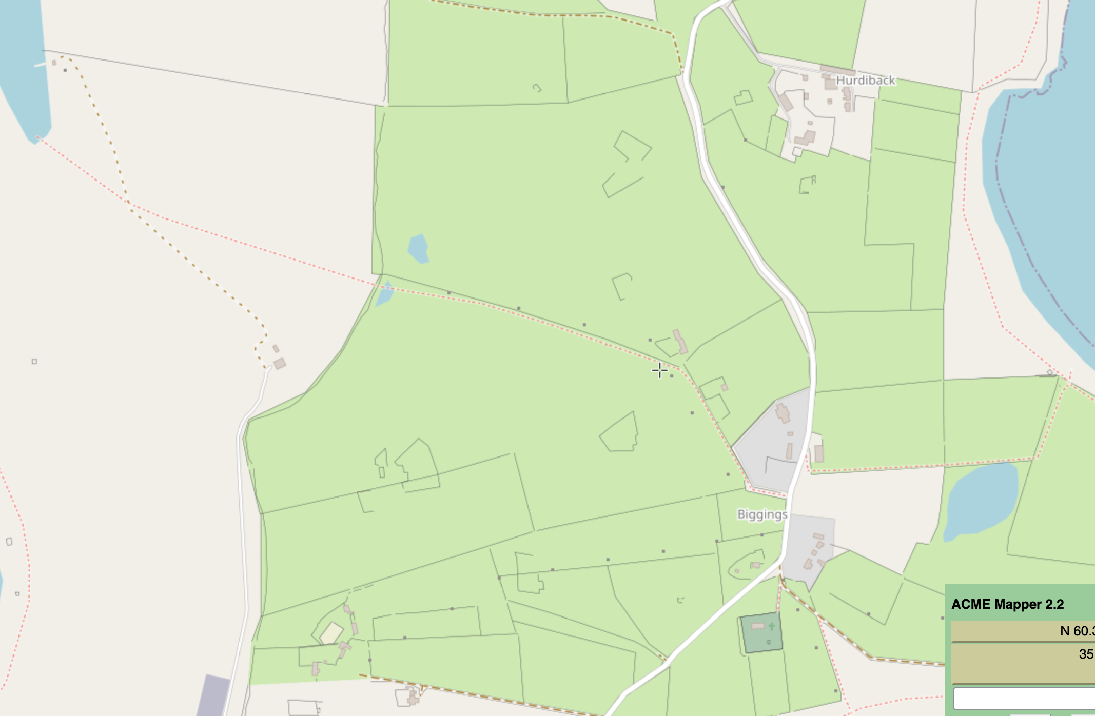
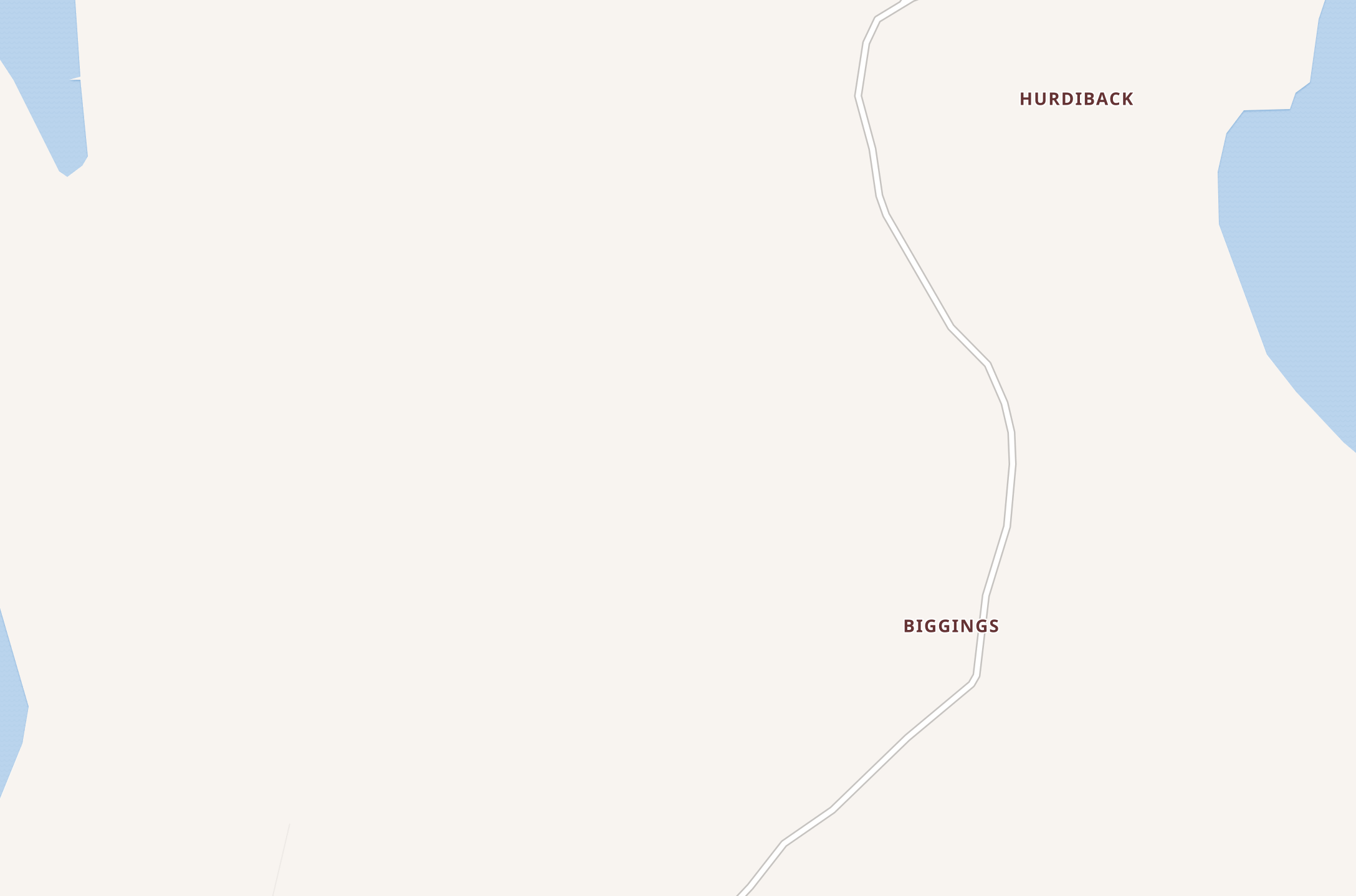
Example: Haroldswick, Shetland, zoom=16:
https://mapper.acme.com/?ll=60.78805,-0.82762&z=16
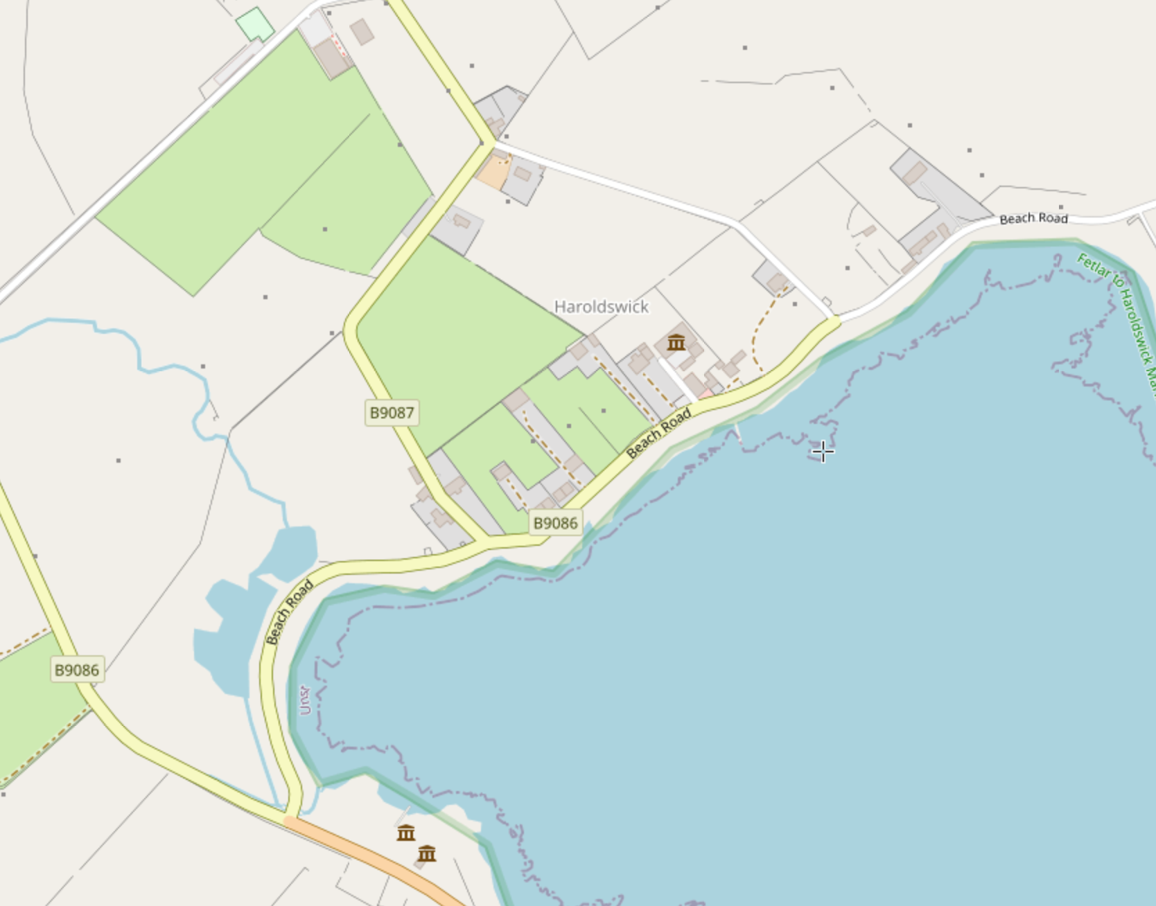
https://www.openstreetmap.org/#map=16/60.7892/-0.8299
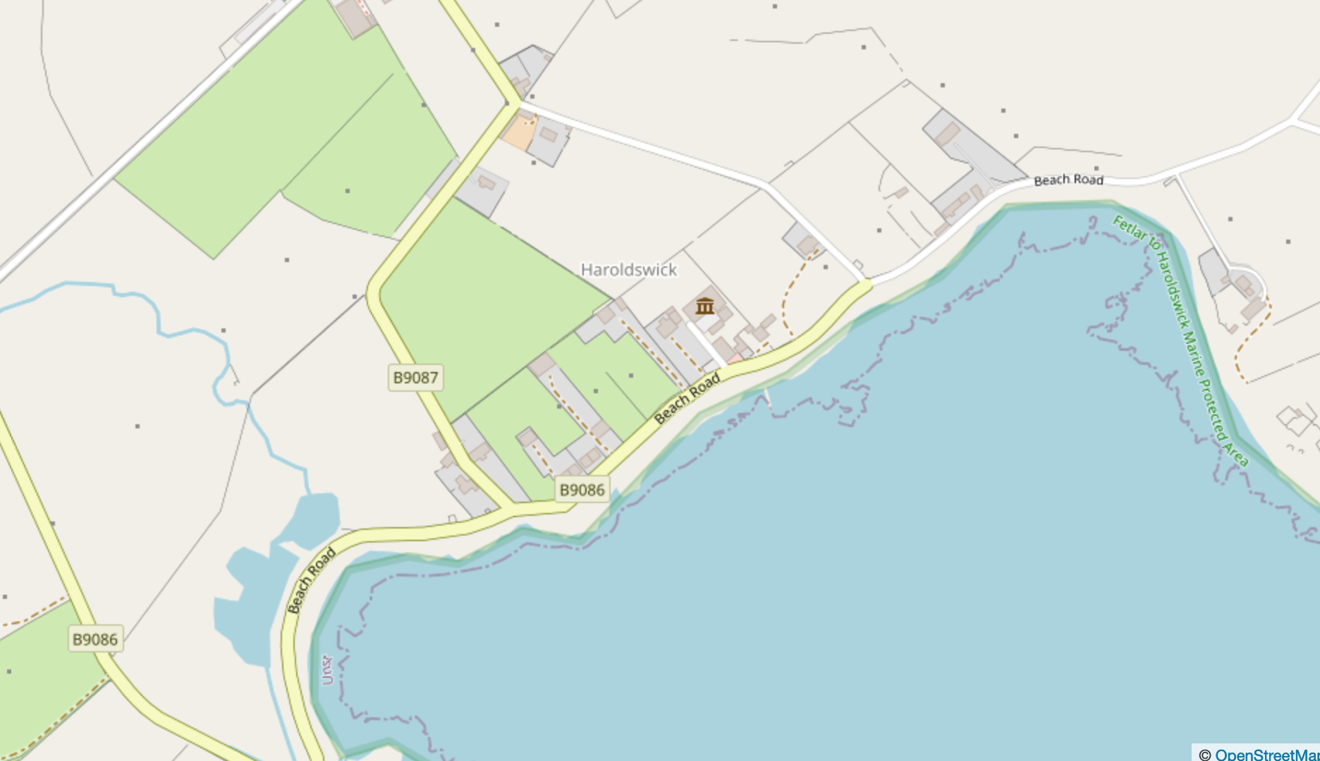
https://maps.wikimedia.org/#16/60.7881/-0.8280
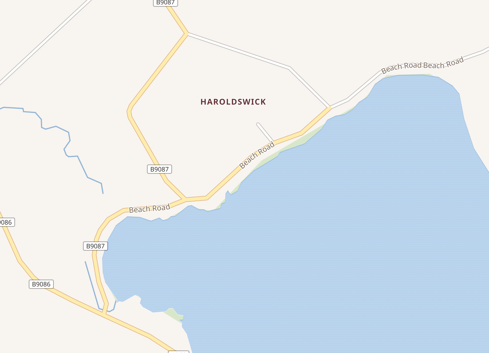
The ask is that WMF maps team analyses OSM's map default presentation in terms of which types of nodes, ways and relations are shown at which resolutions, and modify arrangements for tile import such that WMF maps show detail comparible with OSM/ACME for each resolution.